Technopark Izmir South Campus


- Project Date: 2022
- Location: Urla, Izmir
- Client: Izmir Institute of Technology
- Project Team: Cem Ilhan, Tulin Hadi, Sezin Beldag, Efe Toz, Aysegul Ersin
- Typology:
- Education
- Landscape Architecture
- Research
Main Approach
Technopark areas are very important intersections and meeting centers that focus on creative and innovative energy at the interface of the academic and practical world, and are living ecosystems that bring together different social and economic stakeholders. All these features bring the spatial design of a technopark campus as an important problem to us, because this spatial structure emerges as an important element that triggers and enriches creativity and innovation. This need for design becomes even more important in campuses that exceed the scale of a single structure, and the systematic of closed, semi-closed and open areas created becomes an important component in achieving the goals of the technopark. Based on these data, the Technopark Izmir Campus that we have designed is integrated into the existing network at the scale of the country, the city, and the campus and its immediate surroundings, and while doing so, it aims to take it to higher levels in every sense with the spatial and social structure it proposes.
Urban Design
Considering that urban and global life practices are rapidly changing today, spatial usage and activities should be expected to be flexible enough to adapt to the pace of change and to ensure that they are experienced continuously. The active and passive usage scenarios of the mentioned spatial diversity, the ecological data of the geography, the differentiation in user experience in different seasons and the changes in nature are suggested, and solutions that will enable the continuity of practical spatial activities are proposed.
Pedestrianization of the Campus Main Axis
The potential created by the linear axis and strong relationship of the connection road extending approximately on the northeast-southwest axis between the university, which can be considered as the heart of the Izmir Institute of Technology, and the existing technopark, has been ignored in the current area use. The approximately 1-kilometer main axis used as a vehicle road connection has been considered as the main carrier of the proposed spatial structure and area use, the integration interface, and the backbone of daily life, encounters and access, and has been pedestrianized. The pedestrian circulation extending to the heart of the existing campus with the proposed pedestrian spine is integrated with the pedestrian square by extending to the existing technopark and the proposed linear and uninterrupted connections in the southwest and pulling up to the technopark development area. The pedestrian spine, where spatial stratification and different functions on the campus are articulated, is proposed as an experience space, a gathering and distributing public structure where all pedestrian user groups can spend time together, in addition to providing circulation between different spaces.
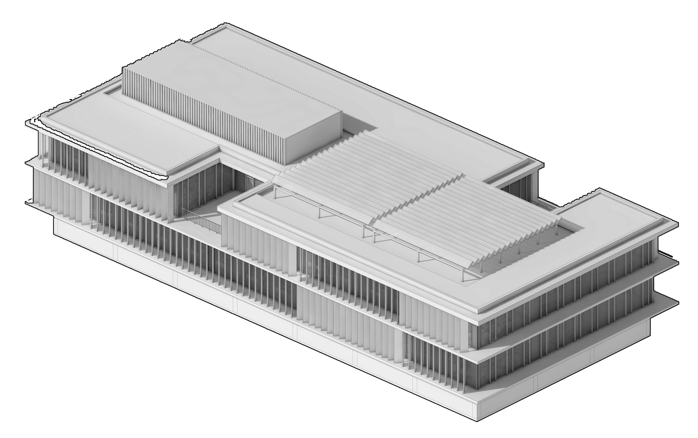
Climate and Material
The spatial experience of the mentioned climatic condition has been taken into consideration in the shaping of the project approach and masterplan structure, where the use of open spaces is especially emphasized. In addition to the vegetative landscape structure that prioritizes the continuity of natural landscape areas, material selections are suggested in accordance with the mentioned climatic requirements. In spatial design areas where the ecological precast material palette is at the forefront, it is suggested that the intense light created by the long sunny days, especially in the summer months, will not disturb the users and will absorb solar radiation rapidly.
Campus Relations
The existing technopark settlement, which is seen as problematic because it is divided by the D-300 highway and directly connected to the expansion area located in the south, which is used as a vehicle road today, will gain a holistic character around the proposed alley and pedestrian spine, and strengthen the interaction with the faculties, departments and laboratories that are articulated as they extend north with the technopark expansion area at the southern end. The continuity of the ring road located at the periphery of the campus will be provided in the south direction as well, and vehicle traffic will be provided with this ring circulation, and the continuity of pedestrian access will be brought to the forefront with the horizontal connection and parking areas proposed on the existing building perimeters.
Campus Structure
When the positive effect that social encounters, public area activities and sharing will create on education, culture and creativity is considered, it is understood how fragmented and inaccessible the campus that seen as physically integrated actually is. The university campus, which is primarily the center of science and education, should have a holistic social spine. The direct relationship that this spine will establish with the existing technopark and the proposed expansion area will be formed with the alley, and with the sub-uses of the proposed alley, the aforementioned spine will actually become the social promenade of the campus. In this way, it is considered important that the sub-arrangements and space uses that will integrate with the main spine will transform the campus master plan in the long term and provide the spatial infrastructure of the flexible and holistic university education that is proposed to be foreseen.
Public Open Space Systematics
The masterplan settlement structure, where the use of public open space is prioritized, sees the university area, which has existing open space use but is not reinforced with spatial arrangements, the existing technopark area and the technopark expansion area located south of the highway as a single whole and integrates it by articulating it to a full public interface instead of a hierarchical stratification.